GRAN SASSO THE BIG HORN PEAK
few summers ago we decided to spend the holidays in the Abruzzo National Park the Gran Sasso.
We chose as a base housing a farm in the country of castles, famous for its fine ceramics of exquisite craftsmanship.
Now we were greeted by villagers as if we were da sempre loro compaesani, con il loro tipico spirito di amicizia.....quasi ci sentivamo a disagio non essendo abituati a tanto.
Ancora ce lo ricordiamo piacevolmente ed ogni tanto ci viene voglia di ritornare.....
Sicuramente non mancheremo di ritornarci anche perche' l'Abruzzo e gli Abruzzesi sono meravigliosi.
La terra con i suoi "tremori" e' stata crudele e spietata con loro.
Sicuramente non vanno perse le occasioni per aiutarli e vi consiglio vivamente di farlo in ogni modo perche' le occasioni anche piccole non mancano.
In quel periodo ne abbiamo approfittato per girare in lungo ed in largo Campo Imperatore e la sua corona di montagne, ci sembrava di essere nel nostro parco divertimenti preferito!
Tra le varie escursioni che abbiamo fatto la piu' conosciuta e' quella di salire in vetta al Corno Grande del Gran Sasso per la via Normale.
Dopo aver parcheggiato all'Albergo di Campo Imperatore (mt.2120) famoso anche per aver ospitato in via forzosa Mussolini che poi venne liberato con un blitz aereo dai tedeschi che lo prelevarono dopo aver usato la piana di Campo Imperatore come pista di atterraggio, siamo saliti per il sentiero verso il rifugio Duca degli Abruzzi (mt.2388).
Dal Rifugio abbiamo proseguito per la Sella di Monte Aquila (mt.2335) oltrepassandola e seguendo il sentiero che domina la Conca degli Invalidi e che aggira in senso orario la montagna con superiormente la sua zona delle creste, e attraversando ghiaioni e detriti con tornanti stretti, easy climb with sections on the rocks.
Below us the valley of the glacier 'most southerly in Europe .... the Calderone Glacier, continuing on the ridge you come to cross the summit of Corno Grande (mt.2914).
The view that you can 'enjoy from that point and' nothing short of spectacular! The Gran Sasso
a real mountain in the sea!
height difference around 800 m in height and the same down the same route back. Difficulty
'EE
really to recommend!
Tuesday, July 27, 2010
Driver For Sound Blaster Ct4870
ALBE LUNAR
place some sunrises moon made the night of 24 and 25 July respectively and Malgasass Rizzolaga, the photos were taken with canon 40d and 102 taka Tsa
Dawn of the Moon 24/07/10
place some sunrises moon made the night of 24 and 25 July respectively and Malgasass Rizzolaga, the photos were taken with canon 40d and 102 taka Tsa
Dawn of the Moon 24/07/10
the rising moon 25/07/2010
Sunday, July 25, 2010
Cover Letter Dental Hygienist New Grad
NGC 7000 and Sadr
Ultime foto con lo sky 90, temepratura esterna 26° troppo per la povera 40d non raffreddata, l'elaborazione è di 8 pose da 5 minuti con Flat e Dark per la Nord e 15 pose da 5 minuti per la Sadr purtroppo dss mi ha spappolato un po' le stelle...
ecco la Sadr....purtroppo il rumore è notevole, peccato.....
Friday, July 23, 2010
M Jak Milosc Free Online
D' ITALY Refuge Tridentine
Two days Ahr Valley with the objective collection of Italy. The collection of
Italy Klockerkarkopf mt.2912 or so called 'why' and 'the highest mountain' to the north of Italy.
An environment rich in fresh meadows and streams in the valley, a valley being formed in its present form by ancient glaciers, and a harsh environment and "granite" in high altitude.
The excursion organized by the Group of Friends of Mountain Piazzola sul Brenta, 'was a nice "bucks" even if the weather once again and' made to the "whims".
first leg took us up to the warm refuge Tridentine Brigade, and then low clouds and rain soon came to the shelter, and all night with strong wind storms ...... luckily the company del Gruppo con la loro allegria e simpatia ha aiutato a rallegrare il "clima".....
Il giorno dopo al mattino le nuvole basse e la pioggia ci hanno fatto desistere dalla tentazione di raggiungere la cima, anche se ci siamo portati fino al bivio che imboccando il sentiero sulla destra ci avrebbe portato alla vetta.
Peccato.....lo abbiamo ritenuto troppo pericoloso......in compenso abbiamo chiuso il giro portandoci a incrociare di nuovo il sentiero n.13.
"Umidi" ma contenti !
IL PERCORSO :
Primo giorno.
Arrivati a Casere mt.1595 si prosegue per la strada sterrata che porta alla malga "Kerher Alm" mt.1846 e seguendo il sentiero n.13 si giunge alla malga Lahner mt.1979.
Procedendo per il sentiero comodo e ben segnalato si rises steadily to reach the Tridentine mt.2441 Refuge. Meanwhile
Picco dei Tre Signori with its majestic silhouette "monitor" every move of the hikers who climb to the refuge .....
Day.
Following the path n. 13 which is also called the Via collection of Italy will come to the fork to the right that leads to the collection.
Continuing along the same path you advance past the fork Teufelstiege mt.2526, is around the "Costa del Prete" and follow the path you come to the refuge collection of Italy and 'closed and therefore does not provide emergency shelter also.
just after hooking the hut down the path n. 14 which leads down steeply us' downstream to Casere.
Ascending mt.846-Difficulty 'E
difference in drop-down-mt.1400 Difficulty' EE
time there and 'state aid .... collection of Italy soon!
Monday, July 19, 2010
Monday, July 12, 2010
Nj Unemployment After Temporary Disability
WILD MOUNTAIN TOP AUCTION Rif.Ottone Brentari
Some time ago, always with my friend Paul we held an exit zone on a little 'forget mass from the excursion. A
Cima d'Asta along the High Street Granite.
Even at that time for a change the Weather and there 'been a friend accompanying us with rain beginning to end, I must say that personally apart from the discomfort it creates, I love through the woods during a rain' cause you feel smells sublime, and to be with a shower in among the rocks makes me feel all the strength that can 'develop nature.
Anyway I highly recommend not to go hiking with adverse weather conditions for the various security problems that entails.
back to us after parking up to the hut Sorgazza mt.1450 Coming from Valsugana Tesino Parish and across the Val Malene, we walked the dirt road that corresponds with the CAI 327 High Street to Granite mt.1647 crossroads where you follow the right path 327 to the shepherds' huts mt.2131 where we saw the bad weather we have taken the easy "electrode of Donkeys" marked with the number 327B to reach through a spectacular and unique area of \u200b\u200bblack granite, color, made more so 'the rain .... we finally reached the lake and the Cima d'Asta earned Refuge Brass Brentari mt.2480.
Given the rain we stopped them and we have not come in the most 'high Cima D'Asta mt.2847.
Come back we went out for Laste variant 'of Cima d'Asta accompanied by the stream coming down hard from the lake, and with some difficulty' for a bit of granite plaques' slippery path CAI 327. Then we
curves with the same route.
Difference: mt.1020 went back mt.1020. However
be redone with the nice weather!
Sunday, July 11, 2010
Easton Sv12 Ssv1b Bat Review
MONTE Obante Group Carega
along the European path E5 an easy climb to the Group of Carega.
That 's the description given by the popular online encyclopedia Wikipedia: The European path
E5 is a European route from the Atlantic coast in Brittany (France) through the Swiss Alps through Switzerland, Germany, Austria and reaches the 'Italy ending second project in Venice. The total distance is 3200 km. Currently past Verona, Venice is not defined, so the path ends at the Arena di Verona.
The most common route is that from Lake Constance to Verona: a journey of 600 km for which on average are needed for a good walker about 30 days' journey. This trait was defined by Hans Schmidt of Sonthofen interconnecting existing trails and built by the European Federation Hikers who inaugurated July 2, 1972.
Although the trail passes through rocky areas also with high peaks, requires no experience of climbing. Along the route there are several possibilities for shelter and typically overnight in mountain huts.
The Italian section of the trail:
Timmelsjoch->
St. Leonhard St. Leonhard -> Hut Point Hut Point
Cervinia Cervinia -> San Genesio Atesino
San Genesio -> Bolzano Bolzano
-> Nova
Nova Levante Levante -> Cembra
Cembra -> Palu Palu Fersina
Fersina -> Vitriol Vitriol
Terme Terme ->
Levico Terme Levico Terme -> coal at Folgaria
Carbonare -> Posina
Posina -> Campogrosso
Refuge Refuge Campogrosso -> Giazza
Giazza -> Verona
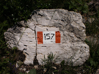
Parked l'auto al Passo di Campogrosso mt.1456 arrivando da Recoaro Terme si procede a piedi per la strada carrabile e ad un certo punto a sinistra si trova l'inizio del sentiero CAI n.157 e imboccato il sentiero si attraversano il Passo delle Buse Scure la Sella del Rotolon fino al bivio del Boale dei Fondi mt.1632.
Lo spettacolo e' a dir poco grandioso sovrastati dalle Guglie del Fumante che si slanciano come una cattedrale gotica verso il cielo.
Tenendo la sinistra si incomincia una ripida salita in un giaione colonizzato dai mughi ed attraversando anche alcune roccette si giunge alla Bocchetta dei Fondi mt.2040.
La vista da qua sopra si apre grandiosa sul Gruppo del Carega e sul Rif.Scalorbi.
A sinistra molto facilmente si puo' raggiungere l'Obante mt.2020.
E' molto facile incontrare camosci, noi ne abbiamo avvistato uno vicinissimo, mentre scendevamo per lo stesso itinerario, che si arrampicava su rocce su passaggi incredibili degni del miglior alpinista.
Subscribe to:
Posts (Atom)